Item detail - Results
New Search
Report an error or omission in this item's data
New Search
| Item | 3388 |
|---|---|
| UDC Class: | 631.4 (829.1) |
| Title: | Topographic map of the Falkland Islands |
| Subtitle: | Sheet 1354B - Eastern sheet |
| Language: | English |
| Subjects: | topography |
| Publication Date: | 1883 |
| Publisher’s Name: | The Admiralty, UK |
| Place of Publication: | London |
| Project Sponsor: | The Admiralty, UK |
| Author: | Brenna, S. et al. |
| Material Extent: | Map sheet |
| Material Characteristics: | Map sheet |
| Material Type: | Map sheet |
| Summary Abstract: | One of two historic maps of the Falkland Islands (East and West sheets). Black and white with annotations in ink on the margin which relate to soil and landscape characteristics. These notes are undated but likely to be last century. The maps are based in the 1883 mapping by Captain Fitzroy of HMS Beagle on a voyage with Charles Darwin. Blog post for the map at https://www.wossac.com/blog.cfm#010823. |
| Country Now: | Falkland Islands |
| Northernmost Latitude (decimal degrees): | -50.83 |
| Southernmost Latitude (decimal degrees): | -52.67 |
| Easternmost Longitude (decimal degrees): | -57.5 |
| Westernmost Longitude (decimal degrees): | -59.5 |
| Document File: |  Falk_W3388.jpg (46.77 Mb) Falk_W3388.jpg (46.77 Mb) |
| Thumbnail: | 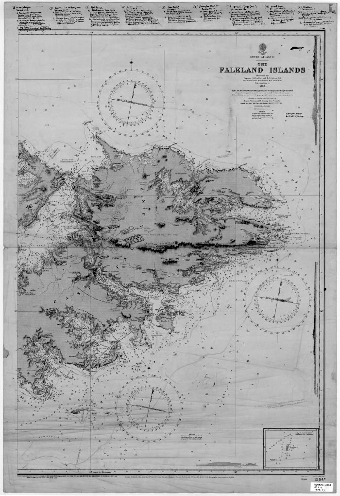 |
Report an error or omission in this item's data
New Search