Item detail - Results
New Search
Report an error or omission in this item's data
New Search
| Item | 42187 |
|---|---|
| UDC Class: | 631.471(676) |
| Title: | A Provisional Soil Map of East Africa |
| Subtitle: | Kenya, Uganda, Tanganyika, and Zanzibar with Expalanatory Memoir |
| Language: | English |
| Subjects: | Soil Survey, Soil Mapping |
| Publication Date: | 1935 |
| Publisher’s Name: | East African Agricultural Research Station, Amani, Tanganyika Territory |
| Place of Publication: | London |
| Author: | Milne, G. |
| Material Extent: | 34 Page Report / Memoir and accompanying map |
| Material Characteristics: | Printed Bound Report |
| Material Accompanying: | Soil Map |
| Material Type: | Perfect Bound |
| Country Then: | Tanganyika |
| Country Now: | Tanzania |
| Region: | East Africa |
| Northernmost Latitude (decimal degrees): | -0.5 |
| Southernmost Latitude (decimal degrees): | -12.3 |
| Easternmost Longitude (decimal degrees): | 41 |
| Westernmost Longitude (decimal degrees): | 28.3 |
| Map Scale: | 2000000 |
| Document File: |  WOSSAC_42187_Report_Map.zip (152.27 Mb) WOSSAC_42187_Report_Map.zip (152.27 Mb) |
| Thumbnail: | 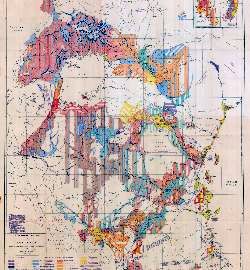 |
| Access Terms: | Please contact WOSSAC |
Report an error or omission in this item's data
New Search