Item detail - Results
New Search
Report an error or omission in this item's data
New Search
| Item | 37417 |
|---|---|
| UDC Class: | 631.442 (683.4) |
| Title: | Soil Map of Swaziland |
| Subtitle: | Southern Sheet |
| Language: | English |
| Subjects: | Soil Survey, Soil Classification, Soil Sets, Soil Series, Soil Profile Features. |
| Publication Date: | 1968 |
| Publisher’s Name: | Permanent Secretary for Agriculture (Mbabane). |
| Place of Publication: | Mbabane |
| Project Sponsor: | Ministry of Agriculture, Mbabane |
| Corporate Author: | Ministry of Agriculture, Mbabane |
| Author: | Murdoch, G. et al |
| Material Extent: | One map sheet of 2. |
| Material Characteristics: | Printed colour paper map with legend and location map. |
| Material Accompanying: | "Soils and Land Capability in Swaziland", Ministry of Agriculture Bulletins 23-25; G. Murdoch, 1968. |
| Material Type: | Loose map sheet in map cabinet |
| Summary Abstract: | This map forms part of a set of 2 coloured soil maps (Northern & Southern Sheets), covering the territory of (now) Eswatini. Southern Sheet, at 1:125,000 scale, covers the southern half of the country, and depicts the distribution of 32 soil sets, based mainly on modal series within each soil set and broad soil mapping units.The base map shows the location of towns, villages, road and railway network, international and district boundaries, rivers and other topographic features.See also Wossac Id: 37418 (Northern Sheet), 45896 & 45897 |
| Country Then: | Swaziland |
| Country Now: | Eswatini |
| Region: | South East Africa |
| Nearest City: | Sidvokodvo |
| Northernmost Latitude (decimal degrees): | -26.5 |
| Southernmost Latitude (decimal degrees): | -27.319 |
| Easternmost Longitude (decimal degrees): | 32.125 |
| Westernmost Longitude (decimal degrees): | 30.8055 |
| Map Sheet: | Southern Sheet |
| Map Scale: | 125000 |
| Document File: |  37417.jpg (55.35 Mb) 37417.jpg (55.35 Mb) |
| Thumbnail: | 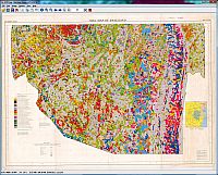 |
Report an error or omission in this item's data
New Search