Item detail - Results
New Search
Report an error or omission in this item's data
New Search
| Item | 35751 |
|---|---|
| UDC Class: | 631.473 (624) |
| Title: | Estimation of Irrigable Areas in the Sudan 1951-3 |
| Subtitle: | Map Supplement to Report by Sir Alexander Gibb and Partners |
| Language: | English |
| Subjects: | Soil Survey, Irrigation, Land Use |
| Publication Date: | 1954 |
| Publisher’s Name: | Sir Alexander Gibb and Partners |
| Project Sponsor: | Sudan Government |
| Corporate Author: | Sir Alexander Gibb and Partners |
| Material Extent: | 87 maps sheets |
| Material Characteristics: | Atlas |
| Material Accompanying: | Item 27204, 35736, 35737, 35738, 35739, 35740, 35741, 35742, 35743, 35744, 35745, 35746, 35747, 35748, 35749, 35750, 35751, 35752, 35753, 35754, 35755, 35756, 35757, 35758, 35759, 35760, 35761, 35762, 35763, 35764, 35765, 35766, 35767, 35768, 35769, 35770, 35771, 35772, 35773, 35774, 35775, 35776, 35777, 35778, 35779, 35780, 35781, 35782, 35783, 35784, 35785, 35786, 35787, 35788, 35789, 35790, 35791, 35792, 35793, 35794, 35795, 35796, 35797, 35798, 35799, 35800, 35801, 35802, 35803, 35804, 35805, 35806, 35807, 35808, 35809, 35810, 35811, 35812, 35813, 35814, 35815, 35816, 35817, 35818, 35819, 35820, 35821, 35822, 35823, 35824 |
| Material Type: | Paper Map |
| Summary Abstract: | Maps of an estimation of irrigable areas in the Sudan. |
| Country Now: | Sudan |
| Northernmost Latitude (decimal degrees): | 12.619999999999999 |
| Southernmost Latitude (decimal degrees): | 12.5 |
| Easternmost Longitude (decimal degrees): | 33 |
| Westernmost Longitude (decimal degrees): | 32.869999999999997 |
| Map Sheet: | 55N 3/16 |
| Map Scale: | 25000 |
| Document File: |  35751.jpg (7.29 Mb) 35751.jpg (7.29 Mb) |
| Thumbnail: | 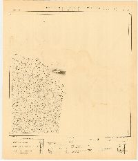 |
Report an error or omission in this item's data
New Search