Item detail - Results
New Search
Report an error or omission in this item's data
New Search
| Item | 25207 |
|---|---|
| UDC Class: | 631.471 (676.2) |
| Title: | Explanatory Soil Map and Agro-Climatic Zone Map of Kenya, 1980 |
| Subtitle: | |
| Language: | English |
| Subjects: | Map, Soils, Agro-Climate, Soil Survey, Soil Classification, Land Evaluation, Agriculture |
| Series Title: | Explanatory Soil Survey Report |
| Series Section Number: | E1 |
| Publication Date: | 1982 |
| Publisher’s Name: | Kenya Soil Survey, Ministry of Agriculture - National Agricultural Laboratories |
| Place of Publication: | Nairobi, Kenya |
| Author: | Sombroek, W. G. et al. |
| Material Extent: | 56pp plus 4 maps (1:1,000,000) |
| Material Type: | Report perfect bound, report and maps in box |
| Summary Abstract: | The present report of the Explanatory Soil Map and Agro-Climatic Zone Map of Kenya is the first of the Kenya Soil Survey explanatory survey reports to be printed. The report serves as an explanatory note to the soil and agro-climatic zone maps of Kenya. |
| Country Now: | Kenya |
| Northernmost Latitude (decimal degrees): | 5 |
| Southernmost Latitude (decimal degrees): | -5 |
| Easternmost Longitude (decimal degrees): | 42 |
| Westernmost Longitude (decimal degrees): | 34 |
| Map Scale: | 1000000 |
| Document File: |  25207_KenyaSoil.zip (54.97 Mb) 25207_KenyaSoil.zip (54.97 Mb) |
| Thumbnail: | 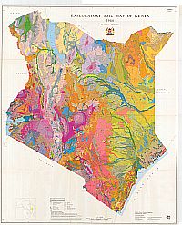 |
Report an error or omission in this item's data
New Search