Item detail - Results
New Search
Report an error or omission in this item's data
New Search
| Item | 24487 |
|---|---|
| UDC Class: | 631.442 (510) |
| Title: | Tentative Soil Map of China |
| Subtitle: | Geological Survey of China - 1:20,000,000 |
| Language: | English |
| Subjects: | Soil Classification, Soil Orders, Soil Great Groups, Soil Mapping |
| Series Title: | Bulletin of the Geological Society of China |
| Series Section Number: | XIV |
| Series Section Name: | 2 |
| Publication Date: | 1935 |
| Publisher’s Name: | Geological Society of China |
| Place of Publication: | China |
| Project Sponsor: | Geological Society of China |
| Corporate Author: | Geological Survey of China |
| Author: | Thorp, J. |
| Material Extent: | One map sheet |
| Material Characteristics: | Printed, black and white, map at scale 1:20,000,000, with legend in English |
| Material Type: | Paper map sheet |
| Summary Abstract: | This item presents a black & white map, at 1:20,000,000 scale, showing an early tentative classification, distribution and description of the important soils of China, published in 1935 by the Geological Society of China. The map depicts the distribution of 22 soil map units, mainly Soil Groups, which are categorised into 9 main Soil Great Groups, which in their turn are grouped into two Orders: A. Pedalfers, and B. Pedocals. |
| Country Now: | China |
| Region: | East Asia - China |
| Nearest City: | Beijing |
| Northernmost Latitude (decimal degrees): | 50.1 |
| Southernmost Latitude (decimal degrees): | 15 |
| Easternmost Longitude (decimal degrees): | 135.08 |
| Westernmost Longitude (decimal degrees): | 72.9 |
| Map Scale: | 20000000 |
| Document File: |  24487.jpg (0.97 Mb) 24487.jpg (0.97 Mb) |
| Thumbnail: | 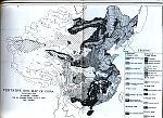 |
Report an error or omission in this item's data
New Search