Item detail - Results
New Search
Report an error or omission in this item's data
New Search
| Item | 198 |
|---|---|
| UDC Class: | 631.4 (881) |
| Title: | Report on the Soil Survey Project British Guiana |
| Subtitle: | Volume VII A Report to accompany a general soil map of British Guiana |
| Language: | English |
| Subjects: | Soil Survey |
| Publication Date: | 1965 |
| Publisher’s Name: | Food and Agriculture Organisation of the United Nations |
| Place of Publication: | Rome, Italy |
| Project Sponsor: | United Nations Special Fund |
| Material Extent: | 142p Report and 4 Map sheets in rear folder |
| Material Characteristics: | Typewritten report with tables, figure and photo. 4 Map sheets in rear folder |
| Material Accompanying: | see Item 199-203 |
| Material Type: | Perfect bound |
| Summary Abstract: | The Soil Survey Project of British Guiana is in seven volumes. A summary table of this WOSSAC material is being prepared for inclusion on the WOSSAC website under country summaries. This volume VII is an overview aa General Soil Map at scale 1:1M,and report (#44996) :Reconnaissance level mapping at at scale 1:500,00 in two parts (#35007 & 35008); and semi -detailed mapping at a number of locations at scale 1:60,000. Both the reconnaissance and semi --detailed mapping have both soil and land capability maps. All maps are coloured with a legend. There is a duplicate on this item at 44996 |
| Country Then: | British Guiana |
| Country Now: | Guyana |
| Northernmost Latitude (decimal degrees): | 8.5 |
| Southernmost Latitude (decimal degrees): | 1.5 |
| Easternmost Longitude (decimal degrees): | -58 |
| Westernmost Longitude (decimal degrees): | -61 |
| Map Scale: | 500000 |
| Document File: |  198_GuyanaSoilMap.pdf (1.29 Mb) 198_GuyanaSoilMap.pdf (1.29 Mb) |
| Thumbnail: | 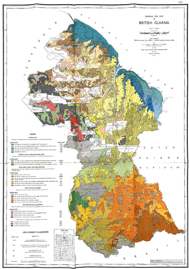 |
Report an error or omission in this item's data
New Search